Farmnavigator Software
Get to work in just few steps!
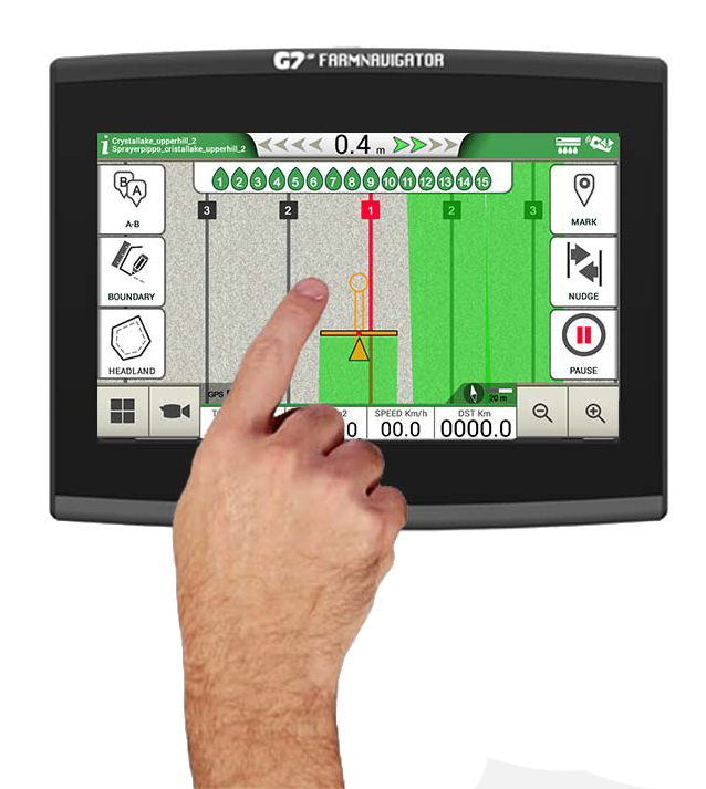
The FARMNAVIGATOR software, perfected for over 15 years, also thanks to customer suggestions, offers advanced functions on a simple farmer-friendly interface, with large and intuitive buttons.
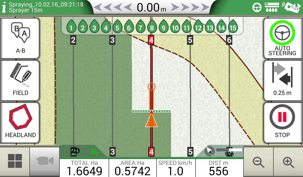
In the field view you can keep an eye on all the most important data and everything is within reach thanks to the collapsible menus.
You can use multiple finger gestures on the display to scroll menus, or to zoom in and out the field view by stretching and pinching with two fingers.
 |
 |
 |
 |
Farmer Friendly Software
The most intuitive yet advanced software for parallel guidance
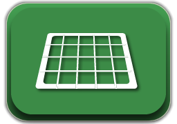
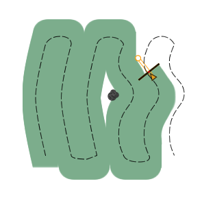
Fields mapping
Start creating your fields’ database:
-
measure your field boundary
-
calculate the area
-
and save the position of obstacles or soil samples.
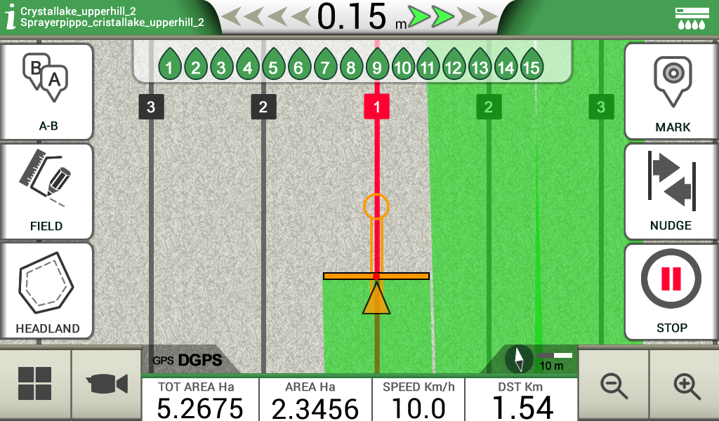
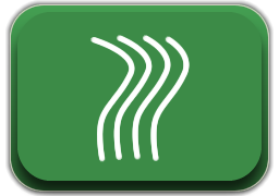
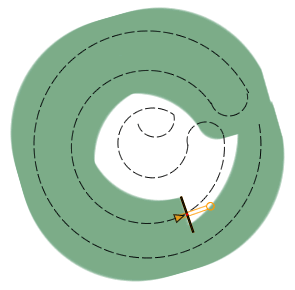
Satellite Assisted Parallel Guidance
Choose the guidelines for your activity and follow the guidance cursor to correct your driving.
-
Choose among A-B parallel lines, identical curves, adaptive contour or pivot guidelines.
-
Save and recall guidelines for further activities in the field.
-
Make sure the guidance line is always visible through the circle on the top of the smart cursor. The cursor will help you understand the tractor turn radius, to quickly correct your steer.
Parallel guidelines
Contour
(Identical curves)
Adaptive Contour
Pivot
Free scheme
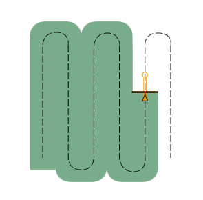
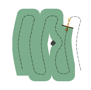
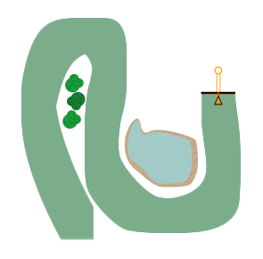
Headland Management
When starting a job, you can create a headland within the field boundary, based on your working width.
-
The Headland Management function is very useful for irregular fields such as triangular fields. When active, the Automatic Section Control will close the sections of the implement at the headland border, the headland can be worked at the end, avoiding unnecessary overlaps.
-
The headland function can be used with A-B parallel guidelines, identical curves and adaptive contour guidelines.
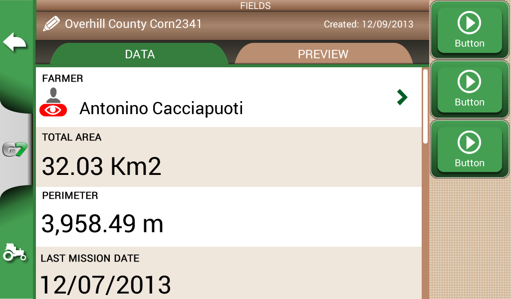
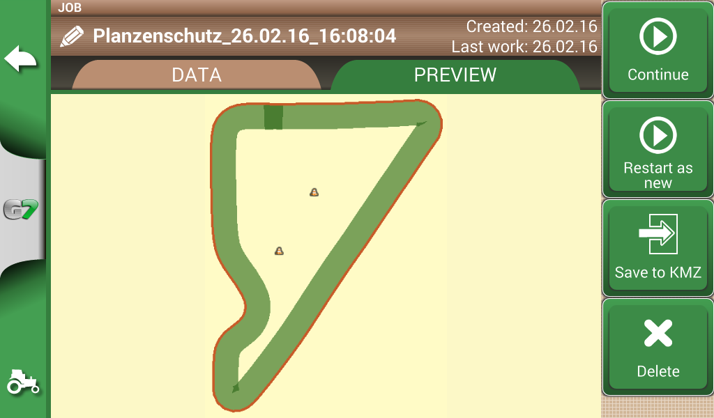
Jobs Database
Farmnavigator records data for each Job: farmer, activity, field, implements used, products used, worked area, total time etc.
-
Manage your data: fields and jobs can be exported to Google Earth as .kmz files.
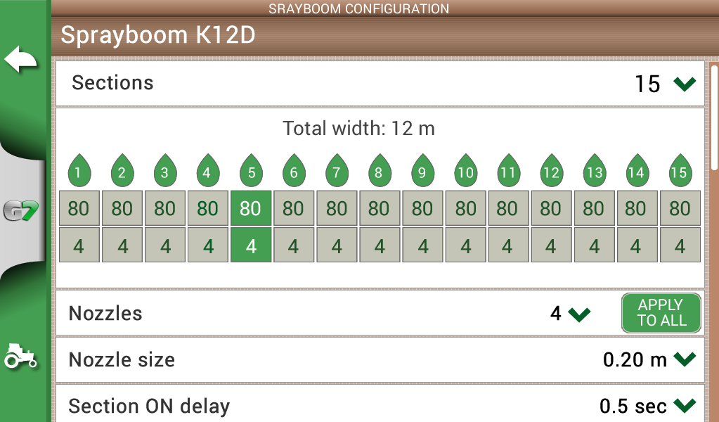
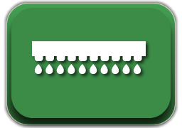
Section Control
Configure and control your implements:
-
Create a profile for each implement and activity e.g. seeding, fertilizing, or spraying: set the working width, or the number of boom sections and their individual width.
-
Then choose a profile and get indications for manual boom switch control to start reducing costs and protecting the environment.
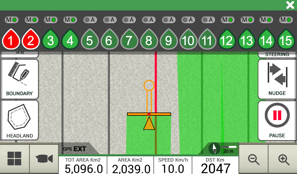
Automatic Control
Connect a compatible controller to G7 Ezy / G7 Plus Farmnavigator for higher precision and greater productivity.
-
Farmnavigator calculates the exact treated area and controls automatically the boom sections based on the position received by the DGPS antenna.
-
You can still close or open manually a section from the display forcing the automatic control.
Compatible controllers:
| Agral Agsis | Caffini CB9 |
| Agromechanika Ag-tronik 14 | Farmscan Unipod |
| Agromechanika Ag-tronik S1 | Hardi HC 5500 |
| Arag Bravo 300s | Hardi HC 5500 |
| Arag Bravo 300s RCU | MC elettronica Hydra 590 |
| Arag Bravo 300s RCU 180s | Rauch Quantron-A |
| Bertolini Buono | Rauch Quantron-E |
| Bogballe Calibrator Zurf | Tecomec Geosystem 260 |
| Bogballe Icon | |
Satellite Navigation
Offline HERE maps
You can use G7 Plus Farmnavigator all year roundas satellite navigator with HERE maps included!
-
Satellite Navigation software by AvMap
-
Turn-by-turn instructions with the Bluetooth speaker.
-
Three available map options: Europe / Brazil / South Africa
*Feature available only for G7 Plus Farmnavigator
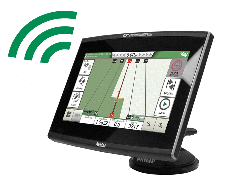
WiFi Updates
No worries
Software updates are done automatically via WiFi, so you do not have to worry aboput complex procedures, you will always get the latest geatures and improvements without any effort.
*Only available for G7 Plus Farmnavigator
Farmnavigator Product line
FARMNAVIGATOR is a brand by AvMap
100% MADE IN ITALY
✔ 30 Years of telematics engineering
✔ Cross-industry experience
✔ In-house production
✔ Cybersecurity certified